
Size Guide
Understanding Mylulusstore Sizing


Description
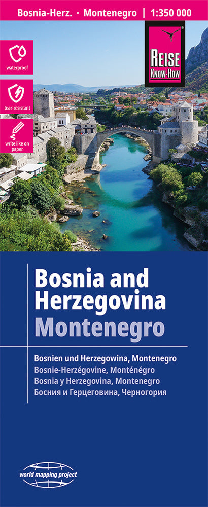
xBosnia-Herzegovina and Montenegro at 1:350,000 on a light, waterproof and tear-resistant, double-sided indexed map published by Reise-Know-How as part of their highly acclaimed World Mapping Project. Altitude colouring with names of numerous mountain ranges, peaks, etc, provides a very good picture of the region’s topography. The whole of Montenegro is shown on one side, and coverage includes Croatian coast south of Sibenik. Within Bosnia, internal administrative boundaries show Republica Srpska where names of main towns are also given in the Cyrillic alphabet.
Road network indicates gravel roads and includes selected local tracks and paths. Scenic routes are highlighted and driving distances marked on main routes. Railway lines are included, local airfields are marked, and along the Croatian coast ferry routes are shown. Internal administrative boundaries are presented with names of the provinces. Symbols highlight various places of interest and facilities, including campsites and mountain refuges, cultural and historical heritage, beaches, etc. Longitude and longitude lines are drawn at 20’ intervals. Map legend includes English.
- Publisert: 2025
- Innbinding: Falset
- Materiale: Plastpapir
- Målestokk: 1:350 000
- Choosing a selection results in a full page refresh.