
Size Guide
Understanding Mylulusstore Sizing


Description
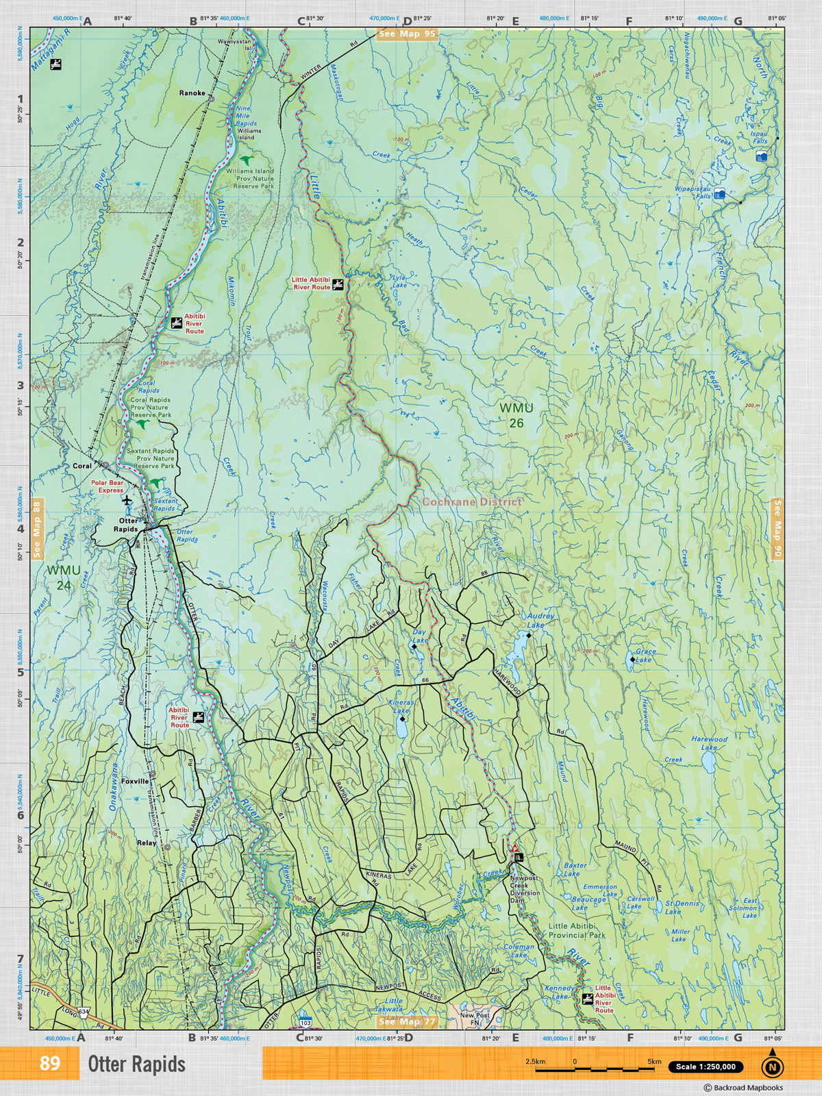
xThis recreation topographic map for Otter Rapids highlights all the logging/resource roads, hunting areas, fishing lakes & streams, campsites, paddling routes for canoeing and kayaking, wildlife viewing areas, multi-use trails for hiking, biking, horseback riding, cross-country skiing and snowshoeing, motorized trails for ATVing and snowmobiling & more. Covering 3,040 km2 (1,170 mi2), this 1:85,000 scale map measures 48 x 63.5 km (30 x 39.5 mi), providing you with more topographic and recreational detail for the Meldrum Bay area than any other map on the market. New features include Crown land areas, countless new roads and trails plus additional recreational Points of Interest. Included on this map are Otter Rapids, Williams Island Provincial Nature Reserve Park, Abitibi River, Little Abitibi River and more! This map also covers the following Wildlife Management Units: WMU 24, WMU 26. Otter Rapids - Northeastern Ontario comes printed on waterproof synthetic material for extra durability.

- Choosing a selection results in a full page refresh.