
Size Guide
Understanding Mylulusstore Sizing


Description
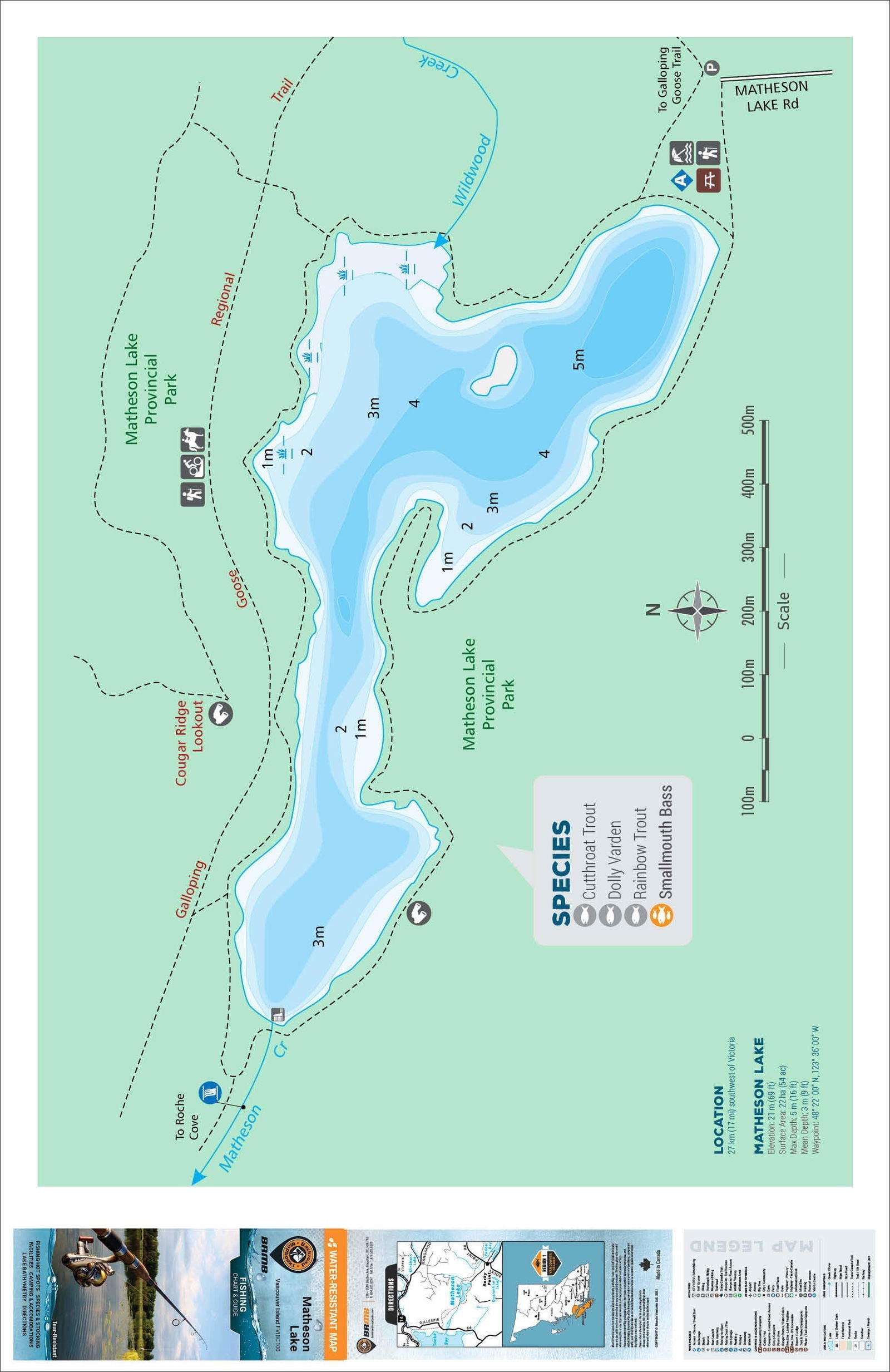
xThis Fishing Chart covers Matheson Lake on Vancouver Island, BC. Resting in BC Fishing Region 1, the map features the lake bathymetry (or lake depths) and shore features including boat launches, campsites, fishing docks, parks and resorts. In addition to road or trail access points, the map also includes the lake location and information such as elevation, surface area, mean and maximum depth, and waypoint. Additional features include the fish species found in the lake, an area indicator or map key, scale bar and map legend.
The map is printed on 61 x 94 cm (24 x 37 inch) paper and comes folded on waterproof paper. There is also the option to have the map come unfolded, as a Wall Map in two different sizes. The folded maps include the map cover, map key/area indicator and map legend. The Wall Map includes the same features but are customized to display nicely and fit into a standard-sized picture frames so you can hang on the cabin, home or workshop wall.
Fishing Charts & Wall Maps
- Large scale maps: printed on large format paper, the lake charts and river map information is easy to read
- Informative: the maps include all the lake and river details including lake bathymetry, shore features and lake or river statistics
- Road and Trail access: unique to these fishing charts are surrounding roads and trails to allow for easier access
- Backroad extras: area indicators, a map legend and fish species are just some of the extras included
- Wall Map option: display your favourite lake or river on the wall with maps tailored for standard picture frames
- Choosing a selection results in a full page refresh.